We are working with the Northeast Houston Redevelopment Council to understand the potential for Green Stormwater Infrastructure (GSI) to reduce the anticipated increase in flood risk resulting from climate change in the Kashmere Gardens and Trinity/Houston Gardens Super Neighborhoods in Houston, TX. A complimentary study is examining the potential of GSI in the Gardens to improve water quality both for neighborhood residents and in Galveston Bay. The study is also examining the potential of GSI to mitigate current flood risks.
Identification of Cost-Effective, Climate-Informed Green Infrastructure Adaptations to Reduce Flood Risk in Houston’s Vulnerable Communities. The project has two primary phases, 1) GSI planning and integrated hydraulic and hydrologic modeling and 2) understanding social barriers to the adoption of GSI. While we are still developing the integrated hydraulic and hydrologic model, initial GSI planning work with the National Stormwater Calculator highlights the potential of GSI to reduce runoff for the dominant land uses in the Gardens (see Table 1).
Table 1. Runoff reduction potential of GSI scenarios for five types of land use
| Strategy | Scenario 1: Very high-density residential | Scenario 2: Moderately high-density residential | Scenario 3: Low-density residential | Scenario 4: Very low-density residential | Scenario 5: Commercial area |
| Avg. annual runoff (in.) before GSIs | 47.63 | 26.83 | 24.68 | 21.01 | 47.42 |
| Avg. annual runoff (in.) after GSIs | 14.59 | 18.72 | 18.74 | 17.46 | 25.35 |
| Runoff reduction (%) | 69 | 30 | 24 | 17 | 47 |
As part of our work, we partnered with Asakura Robinson, a Houston-based landscape architecture firm, to hold a series of rain garden workshops. Residents came together over a few Saturdays to learn about rain gardens and to build a rain garden in the Trinity Gardens Community Garden!
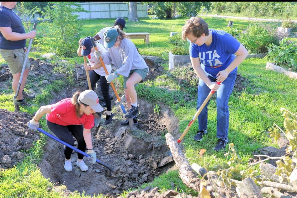
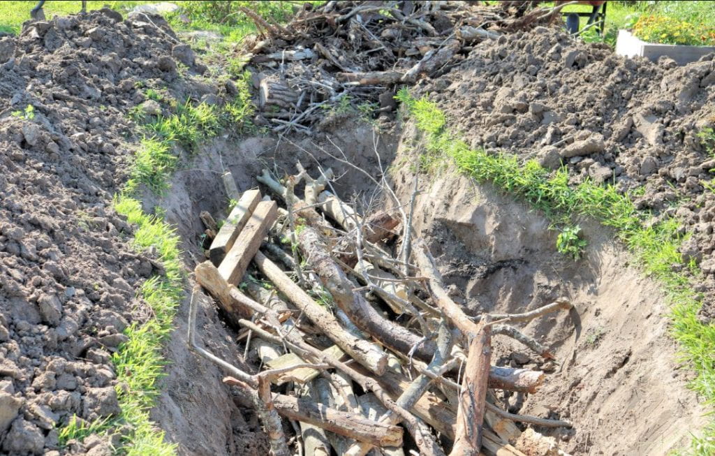
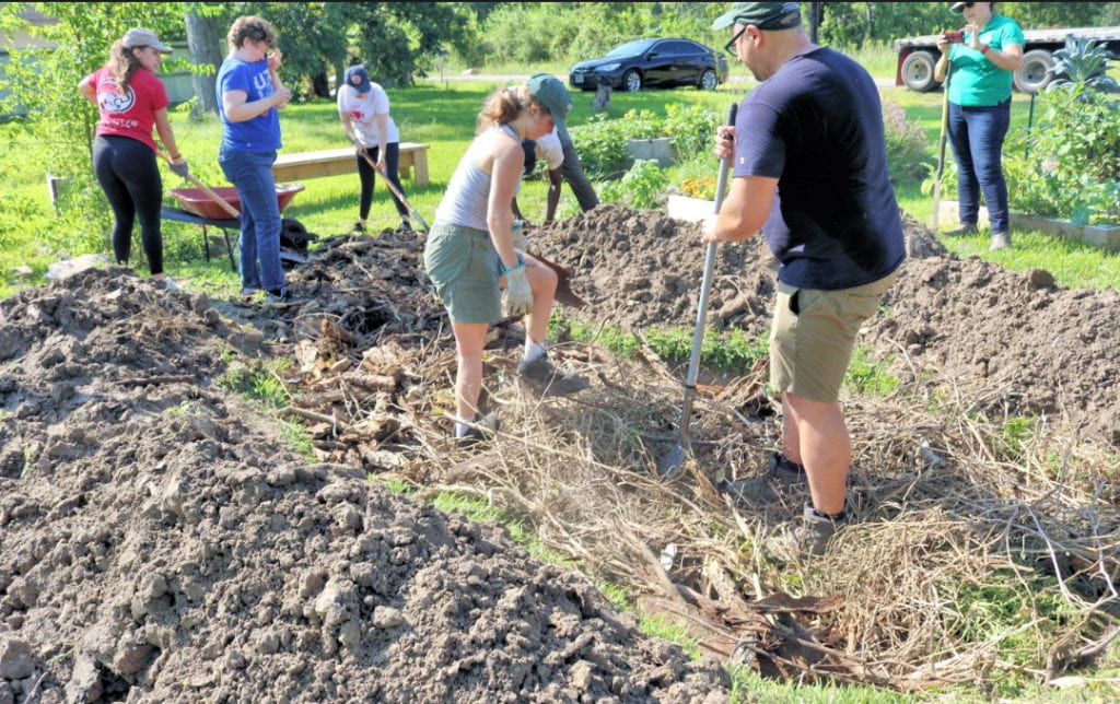
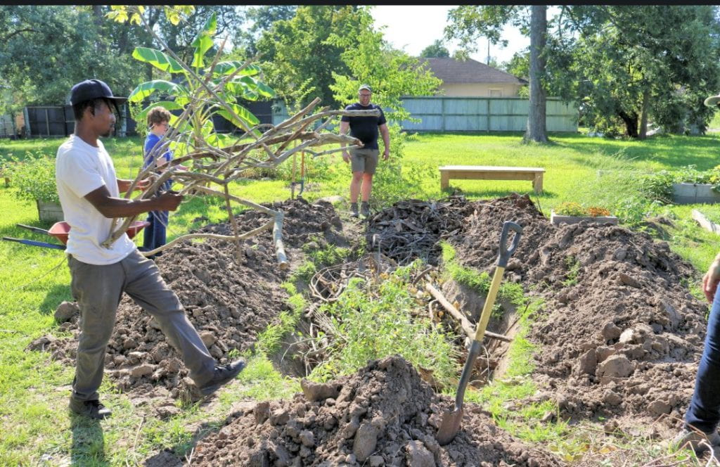
Photo credit: Keith Downey (@houstongent), Kashmere Gardens Super Neighborhood President
Funding provided by NA21OAR4310270.
Identification of cost-effective green stormwater infrastructure to mitigate flooding in Houston’s vulnerable communities and improve Galveston Bay fisheries. The project has two primary phases, 1) GSI hydraulic and hydrologic modeling optimization and water quality impact assessment and 2) understanding barriers to the adoption of GSI at the local government level. Initial GSI planning work with the EPA’s Stormwater Management Model shows the optimal area to convert to different types of GSI for different land uses. For example, see Figure 1 for how different combinations of GSI can reduce runoff volume, peak flow, TSS, and TN for different land uses and the required fraction of available land required to achieve the reductions.
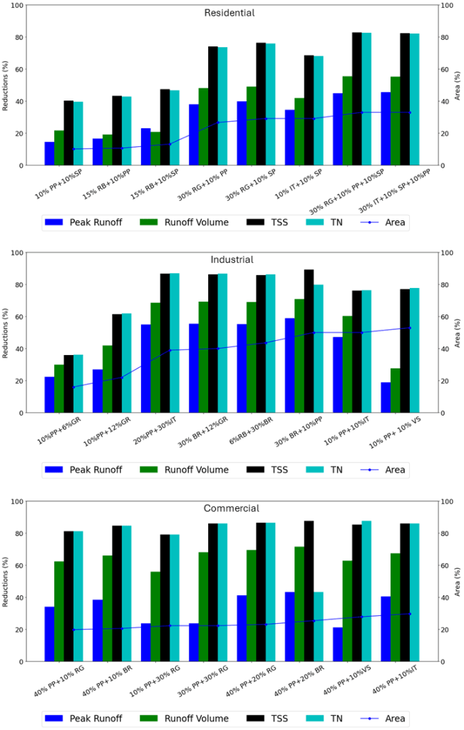
Figure 1. Performance of different GSI combinations for residential, industrial, and commercial land uses (Narzis et al., in production)
Project supported by an Institutional Grant (NA22OAR4170092) to the Texas Sea Grant College Program from the National Sea Grant Office, National Oceanic and Atmospheric Administration, U.S. Department of Commerce.